Fun with maps
-
@dkf said in Fun with maps:
the German site won't actually care too much about being accurate in the non-German parts of the map…
But how are they going to invade it if their maps are not accurate!??
-
@remi Maybe this is a double-think thing, using an inaccurate map in public so as to disguise the fact that their military have accurate maps?
-
@dkf said in Fun with maps:
@Gurth It would depend on the provider of the map data, given that the German site won't actually care too much about being accurate in the non-German parts of the map…
I’m not talking about these specific maps, I’m just using those as an example because they were already known here (to those who read the relevant thread far enough, anyway). This seems to be an issue with many maps in general, is what I’m trying to say.
-
@remi said in Fun with maps:
@dkf said in Fun with maps:
the German site won't actually care too much about being accurate in the non-German parts of the map…
But how are they going to invade it if their maps are not accurate!??
At the roundabout they'll take the third reich

-
It takes almost 3 hours to go from Kissing to Petting, but only 35 minutes to go from Petting to Fucking.

-
@Zecc Good you got that joke in before it stops working on 1 January.
-
I don't think he gives a fugging
-
@Gurth said in Fun with maps:
@Zecc Good you got that joke in before it stops working on 1 January.
 (I'm guessing a town is changing their name?)
Ah, just saw the post in the other thread. (And I guessed good!)
-
@PleegWat said in Fun with maps:
@Luhmann said in Fun with maps:
enclaves
Between Belgium and The Netherlands, even the enclaves have enclaves!
What the actual fuck.
Seems like the inhabitants of #5 Amalia Van Solmstraat have a back room where they canlegallysmoke pot with impunity while in the rest of the house they can't
-
@dcon said in Fun with maps:
Ah, just saw the post in the other thread. (And I guessed good!)
There’s a post about that on here? I heard about the name change on the radio news this morning — never heard about the place at all before then, next you come up with a map of it :)
-
@LaoC said in Fun with maps:
Seems like the inhabitants of #5 Amalia Van Solmstraat have a back room where they can
legallysmoke pot with impunity while in the rest of the house they can't IIRC, inside buildings, the laws apply of the country in which the front door (=official address) is located.
Though there are stories of things like, when the movie Turks Fruit was banned in B•••••m but not the Netherlands in the 1970s, someone setting up a projector and screen on the Dutch side of the border in a hall, and the seats for the audience on the Belgian side.
-
@Gurth said in Fun with maps:
@dcon said in Fun with maps:
Ah, just saw the post in the other thread. (And I guessed good!)
There’s a post about that on here? I heard about the name change on the radio news this morning — never heard about the place at all before then, next you come up with a map of it :)
Would you prefer a dutch version?
What do you think of Neuken / Neuquen in Argentina?

-
@BernieTheBernie said in Fun with maps:
@Gurth said in Fun with maps:
@dcon said in Fun with maps:
Ah, just saw the post in the other thread. (And I guessed good!)
There’s a post about that on here? I heard about the name change on the radio news this morning — never heard about the place at all before then, next you come up with a map of it :)
Would you prefer a dutch version?
What do you think of Neuken / Neuquen in Argentina?
But in these days of covid, we'd better stay closer to home.
-
@Zecc said in Fun with maps:
It takes almost 3 hours to go from Kissing to Petting, but only 35 minutes to go from Petting to Fucking.
-
@BernieTheBernie said in Fun with maps:
Would you prefer a dutch version?
What do you think of Neuken / Neuquen in Argentina?
Thanks, that reminded me of:—

-
Florida Man goes to...
the neighbor over the back fence.
-
@Watson said in Fun with maps:
Florida Man goes to...
the neighbor over the back fence.
That's a First Class Deal by Google, isn't it?
-
The Navajo Nation is a fun one:

The green area is the Navajo Nation, covering parts of Arizon, Utah, and Colorado. The gray areas surrounded by green are the Hopi Reservation. Note the second level enclave. This is pretty boring for this thread until you consider daylight savings; Arizona and the Hopi Reservation do not observe DST, but the Navajo Nation does. Anyone up for a time warp?
-
@abarker said in Fun with maps:
ANyone up for a time warp?
No thanks. The pelvic thrust always drives me insane.
-
@abarker This inspired me to re-watch the CGP Grey video about DST, which features this particular oddity
So, driving across this hundred mile stretch would technically necessitate seven clock changes, which is insane.

-
@hungrier said in Fun with maps:
@abarker This inspired me to re-watch the CGP Grey video about DST, which features this particular oddity
So, driving across this hundred mile stretch would technically necessitate seven clock changes, which is insane.
The only problem is that isn't a road that follows his dotted line very closely, in part because his line appears to start in the Grand Canyon. There is a route that acomplishes the same effect, but it's closer to 200 miles than 100.

Interestingly, because borders and roads don't always get along, the route in gray would need 11 clock changes, and two stretches where you would be on the border between the Hopi and Navajo lands.
-
-
the French have managed to get the Belgians to pay for the upkeep and signage of a French cycle path. Meanwhile, the Belgians, a bilingual nation who speak perfectly good French, have put all the signs in monolingual Flemish.

-
-
-
@hungrier said in Fun with maps:
the French have managed to get the Belgians to pay for the upkeep and signage of a French cycle path. Meanwhile, the Belgians, a bilingual nation who speak perfectly good French, have put all the signs in monolingual Flemish.
This is perfectly explainable: the signs have been put up by a Flemish authority, not a Belgian one. Menen is not a faciliteitengemeente so, based on my observations of B*****m, that means it’s unlikely to do anything at all in French unless it absolutely has to. Its web site doesn’t seem to have a French-language version at all, for example.
-
@Gurth said in Fun with maps:
This is perfectly explainable
Of course but the way the video puts it is much funnier.
-
@Gurth said in Fun with maps:
it’s unlikely to do anything at all in French unless it absolutely has to
it's explicitly VERBOTEN, official signage (road signs, street names, ...) are Flemish only. An old reaction to the Walloon practice of blanking out Flemish names on dual language signs up and until the 80ties.
Only exceptions are directional signs that include foreign cities: Parijs (Paris) but it's also Aken (Achen).
Witch gives extra fun on highways that travel across Flemish, Brussels and Walloon territory, aka the ring roads around Brussels. But since that is by itself a hell hole, a feature only stressed by it's ring road. That isn't an actual ring per se. Or a real highway.
-
@Luhmann said in Fun with maps:
Witch gives extra fun on highways that travel across Flemish, Brussels and Walloon territory, aka the ring roads around Brussels. But since that is by itself a hell hole, a feature only stressed by it's ring road. That isn't an actual ring per se. Or a real highway.
The main reason for me to use the Ring Brussels is when I want to travel south via Luxembourg but I'm towing a trailer. Max speed with a trailer is 90 in NL but 120 in Belgium. The alternative route via Maastricht/Luik involves much more distance in NL.
Of course now that daytime speed limit in NL is 100 everywhere it's probably faster via Brussels even without trailer.
-
@PleegWat said in Fun with maps:
Of course now that daytime speed limit in NL is 100 everywhere it's probably faster via Brussels even without trailer.
word of caution: speed on the Brussels ring road is reduced to 100km/h
one of those things that should have been done a few decades ago but landed in a tow tugging match between the Walloon, Brussels and Flemish politics.
I wouldn't consider doing a dubbel whammer with both the Antwerp and Brussels
ring roadsparking lots a faster solution.
-
@Luhmann said in Fun with maps:
@PleegWat said in Fun with maps:
Of course now that daytime speed limit in NL is 100 everywhere it's probably faster via Brussels even without trailer.
word of caution: speed on the Brussels ring road is reduced to 100km/h
one of those things that should have been done a few decades ago but landed in a tow tugging match between the Walloon, Brussels and Flemish politics.
I wouldn't consider doing a dubbel whammer with both the Antwerp and Brussels
ring roadsparking lots a faster solution.Both Antwerp and Brussels are quite doable if you pick your time of day/week right. I'm not leaving before 8am and I've driven for 2 hours before I reach the Dutch/Belgian border; at that time particularly Antwerp isn't that bad.
And on the leaderboard for
ring roadsparking lots, neither of them has anything on Paris.
-
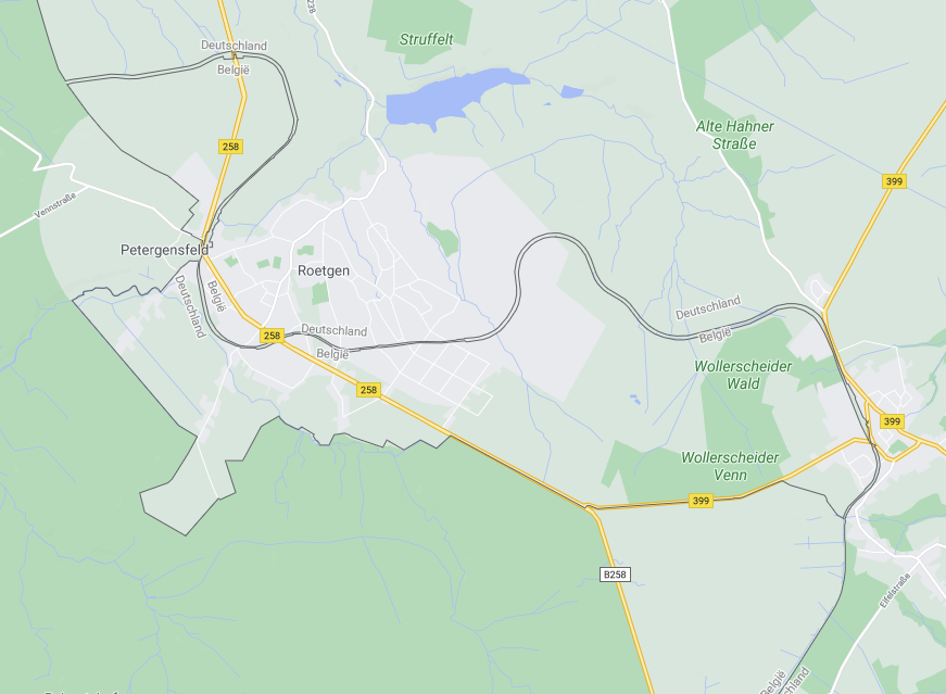
Speaking map and border fuckery ... I present the Vennbahn and claim the prize
Short version:
After WWI Belgium requested German territory up and to including a then important railway line, the Vennbahn that connected Achen with Luxembourg city. UK thought that was a bit much and thus the Versaille treaty only awarded the actual stretch of railway laying isolated in Germany but creating a series of enclaves and counter-enclaves.
The railway is defunct so there is now a Belgian cycling path in Germany.
-
@Luhmann What language are the signs?
-
@Luhmann Incidentally this one too was covered by The Tim Traveller:
https://youtu.be/KEM_cp6hVeM
-
@hungrier
Less of an issue since the region belongs to the Walloon Government (for the road sign stuff) they'll use French as a default but are a tad less anal about it since they share their territory with the German Community Government that is in charge of the cultural/education stuff in the tiny sliver of Germany we did acquire. The rest of the Walloon territory is Governed by the French Community Government. So that makes up most of Wallonia expect the German part but including French speaking people in Brussels ... If you think Belgian constitutional arrangements are of the rails then consider Brussels ...
Belgium! The country that makes weird rules (and ignoring them) an art!
-
@Luhmann Must be fun when appointing high officials... "Sorry we really need a black French-speaking woman this year"
-
@Luhmann said in Fun with maps:
I present the Vennbahn and claim the prize
 - no prize for you
@loopback0 said in Fun with maps:
There's also the Vennbahn which causes this on the Belgian/German border.
-
@loopback0
You know there are days I'm glad we got rid of you lot
-
@Luhmann Every day?
-
What's the relation between the Vennbahn and Venn diagrams?
INB4 a Venn diagram with "Venn" in the intersection
-
@Benjamin-Hall said in Fun with maps:
@Atazhaia IIRC, there's a fair amount of bad blood (not of the shooting kind, but the "longstanding historical grudge" kind) between those two nations. Seems like someone went "nope, not giving you anything extra here. No matter how petty or ridiculous, we'll get every square mm of land we're owed."
There's not really bad blood these days, but Finland was occupied by Sweden a fairly long time so when the lines were drawn up on the map, there probably was.
The border between Sweden and Norway is also updated all the time to make up for changes in the land. Bureaucratic urges are strong in these parts.
-
-
@Zecc
Why so badly clipped? The largest continent is almost completely missing.
 Mercator is ugly and stupid.
-
@Kamil-Podlesak said in Fun with maps:
Mercator is ugly and stupid
Mercator is good for compass navigation.
-
@dkf … which isn't anything anybody would do with a world map on the web.
The main advantage of it for online maps is that you can zoom it anywhere and it will not be distorted without having to change projection. While the changing zoom does not really matter. because everybody zooms to fit area of interest, not any particular numeric value of zoom.
-
@Bulb said in Fun with maps:
it will not be distorted without having to change projection.
 No, you're just used to the distortion. There's literally no way to render the surface of the earth on a flat surface without distortion. You can generally pick which part of the earth has almost no distortion; with the Mercator projection, that part is in the close vicinity of the equator.
-
@dkf Of course every map has distortion. But mercator converges to the actual shape (or local azimuthal projection) anywhere as you zoom it in. Which is the point, mostly.
I do like how Google maps switched to azimuthal projection centred on the middle of the screen, but that requires a vector map. For raster maps Mercator is the compromise.
-
@Bulb said in Fun with maps:
But mercator converges to the actual shape anywhere as you zoom it in.
Most maps do that; the less curvature you have to actually deal with, the better a flat-surface approximation can be. You just center the projection for the piece you're showing on the middle of where you are, and for small maps everything works fine. It's only really once you get to the scale of large countries or continents that things get truly tricky.
-
@dkf No, they don't. The projection must be angle-preserving to do that. If it isn't, then if you zoom in far from the centre, it is all skewed. I don't think any other projection preserves angles globally.
-
@Bulb said in Fun with maps:
@dkf No, they don't. The projection must be angle-preserving to do that. If it isn't, then if you zoom in far from the centre, it is all skewed. I don't think any other projection preserves angles globally.
If you make a star shape with the cuts along the latitude lines and flatten with either pole in the center, you'd get a fairly decent version. You'd just have to ignore the holes between the arms.
Authagraph is a pretty good projection, and it should be used more.

 Baarle-Nassau - Wikipedia

 Sexbierum - Wikipedia

